|
|
 |
White Bass Caught by Rod Augustine |
 |
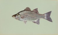
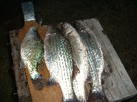
Below are details for all the White Bass caught by Rod Augustine. This view provides a great way to see where and how Rod Augustine caught White Bass.
Sort by: Max Fish Length | Max Fish Weight | Trip Name | # of Fish Caught
| From Trip: | memorial weekend |
| Trip Date: | 5/24/2009 |
| Hotspot Title: | White bass |
| # of Fish Caught: | 30 |
| Fish Length (Average): | 10 inches |
| Fish Length (Max): | 14 inches |
| Fish Weight (Average): | 0 lbs. 0 oz. |
| Fish Weight (Max): | 0 lbs. 0 oz. |
| Bait Type: | Jigs |
| Bait Details: | drifting jig and worm past the fish feeder about 100 yards away. |
| Location Details: | 100 yards to the west of the fish feeder. |
| Longitude/Latitude: | -98.635425567627, 38.9429885494903 | |
| Map It: |  | |
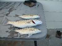
| From Trip: | 3rd times a charm |
| Trip Date: | 5/18/2008 |
| Hotspot Title: | fish |
| # of Fish Caught: | 2 |
| Fish Length (Average): | 16 inches |
| Fish Length (Max): | 0 inches |
| Fish Weight (Average): | 1 lbs. 8 oz. |
| Fish Weight (Max): | 0 lbs. 0 oz. |
| Bait Type: | Worm |
| Bait Details: | fishing with a walleye rig baited with a worm and also minnows |
| Location Details: | from the west end of the lake drifting all the way to goose flats. also caught walleye and wiper here and several drum. |
| Longitude/Latitude: | -99.4690132141113, 39.386988584554594 | |
| Map It: |  | |
 |
| From Trip: | Webster lake |
| Trip Date: | 4/8/2011 |
| Hotspot Title: | white bass |
| # of Fish Caught: | 1 |
| Fish Length (Average): | 16 inches |
| Fish Length (Max): | 0 inches |
| Fish Weight (Average): | 2 lbs. 0 oz. |
| Fish Weight (Max): | 0 lbs. 0 oz. |
| Bait Type: | Crankbait |
| Bait Details: | trolling a shad colored rapala |
| Location Details: | just west of the damn on the north side of the lake. |
| Longitude/Latitude: | -99.431505203243, 39.406953051894995 | |
| Map It: |  | |
| From Trip: | cedar bluff |
| Trip Date: | 5/22/2011 |
| Hotspot Title: | white bass |
| # of Fish Caught: | 1 |
| Fish Length (Average): | 0 inches |
| Fish Length (Max): | 0 inches |
| Fish Weight (Average): | 0 lbs. 0 oz. |
| Fish Weight (Max): | 0 lbs. 0 oz. |
| Bait Type: | |
| Bait Details: | caught one mid size white bass while trolling a shallow water crank bait. had several more bites on it but missed them all |
| Location Details: | river channel on the west end. |
| Longitude/Latitude: | -99.824523925781, 38.782992989977004 | |
| Map It: |  | |
| From Trip: | Webster lake |
| Trip Date: | 7/8/2011 |
| Hotspot Title: | white bass surfacing, missed other bites |
| # of Fish Caught: | 2 |
| Fish Length (Average): | 0 inches |
| Fish Length (Max): | 0 inches |
| Fish Weight (Average): | 1 lbs. 5 oz. |
| Fish Weight (Max): | 1 lbs. 5 oz. |
| Bait Type: | Casting & Trolling Spoon;22 |
| Bait Details: | crankbaits also |
| Location Details: | |
| Longitude/Latitude: | -99.43124771118299, 39.399127130972 | |
| Map It: |  | |
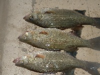
| From Trip: | fall fishing |
| Trip Date: | 9/17/2011 |
| Hotspot Title: | white bass |
| # of Fish Caught: | 5 |
| Fish Length (Average): | 15 inches |
| Fish Length (Max): | 0 inches |
| Fish Weight (Average): | 0 lbs. 0 oz. |
| Fish Weight (Max): | 0 lbs. 0 oz. |
| Bait Type: | Casting & Trolling Spoon;22 |
| Bait Details: | |
| Location Details: | |
| Longitude/Latitude: | -98.60830307007, 38.935244350923995 | |
| Map It: |  | |
 |
| From Trip: | not as good as last weekend. But |
| Trip Date: | 9/24/2011 |
| Hotspot Title: | white bass |
| # of Fish Caught: | 2 |
| Fish Length (Average): | 0 inches |
| Fish Length (Max): | 0 inches |
| Fish Weight (Average): | 1 lbs. 6 oz. |
| Fish Weight (Max): | 0 lbs. 0 oz. |
| Bait Type: | Casting & Trolling Spoon;22 |
| Bait Details: | casting silver spoons |
| Location Details: | weed flats on the south shore west of minooka boat ramp |
| Longitude/Latitude: | -98.60658645629799, 38.93177253908999 | |
| Map It: |  | |
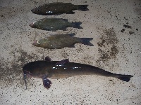 |
| From Trip: | cedar bluff fishing |
| Trip Date: | 3/31/2012 |
| Hotspot Title: | wiper, white bass, crappie |
| # of Fish Caught: | 6 |
| Fish Length (Average): | 0 inches |
| Fish Length (Max): | 0 inches |
| Fish Weight (Average): | 0 lbs. 0 oz. |
| Fish Weight (Max): | 0 lbs. 0 oz. |
| Bait Type: | Nightcrawler |
| Bait Details: | live bait rigs, baited with nightcrawlers being drifted about 30-40 feet down. |
| Location Details: | flat deep bottom |
| Longitude/Latitude: | -99.770278930661, 38.787542525934 | |
| Map It: |  | |
 |
 |
|
 |
|
|
 |
Sponsored Links |
|
 |
|
|


